Copper Canyon
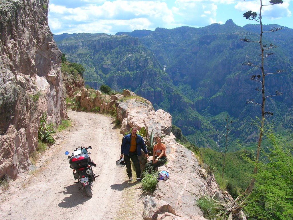 Road overlooking the Copper Canyon
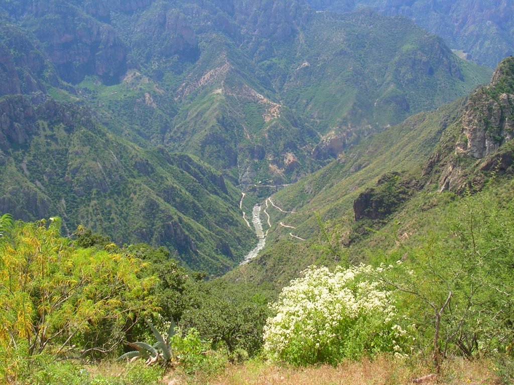 Copper Canyon with the road winding down into the valley
and across the river below
The Copper Canyon is system on deep canyons that began being formed over 40 million years ago during a period of extreme volcanic and earthquake activity which formed plateaus and faults that eroted away with the wind and rain.
Today the mountians are dotted with small farms, mining towns and I'm sure if you look hard enough a Tarahumara indian running on one of the many paths that have been winding through the canyons for hundreds of years. At Creel, which is located near the canyon,the elevation is over 7500 ft. and they do sometimes get snow here on the winter months. The twisty road from Creel to the top of the canyon 70 km. away the road is paved after that the road turns to gravel as it plunges 65 km. into the canyon and the old mining town of Batapila which lies at an elevation of around 1800 ft. It is quite a ride down. The approx. 50 switchbacks that make up the road cut into the side of the canyon and allow amazing views and spectacular scenery.
There is a railway line that runs through one of the canyons and RV's can be put on railway cars and you can travel from Brownsville Tex. to Las Muchas Mex. We didn't take this ride but we did ride the road that runs beside the railroad tracks for about 40 km. to the town of Divisadero which is perched on the edge of a cliff. On a clear day you can see for over a hundred miles, the Copper Canyon is said to be over 4 times bigger than the Grand Canyon. Roads (if you can call them that) have been built to the bottom of some of the canyons crossing rivers and with a different bike and at different time we may try this ride (Terry, Ken is envious). Until then on with our adventure to South America.
posted by world travellers @ 4:01 PM
![]()


1 Comments:
How's the Suzuki running??
Post a Comment
<< Home